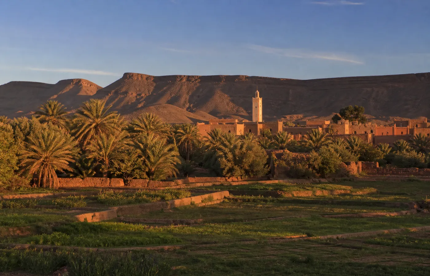
Quick facts
- Where
- Morocco, Tata province
- Altitude
- About 700 m
- Type of access
- Tarmac
- Where to sleep
- Where to stay in Foum Zguid
- In the area
- Erg ChigagaAbout 60 km of track, about 2.5 h by 4x4
- Lake IriquiAbout 40 km of track, about 1 h by 4x4
Between two worlds: the village in brief
- Name: it means "mouth of the Zguid", the river of that name breaking out of the Jbel Bani barrier right here.
- Municipality: 8,660 people (2024 census), Tata province.
- North side: a tarmac road climbing to Taznakht, then on to Ouarzazate and Marrakech.
- South side: no road at all; first the hamada, then Lake Iriqui, then the dunes.
- Its role: this has long been where you stock up, sleep and find a guide before setting out for the desert.
What sets it apart from the big desert gateways: no touts, no loud signs. Instead, a souk on Thursdays where nomads from the area come to trade, cafés where tea is never rushed, and households that live from their date palms at least as much as from visitors.
What to do in and around Foum Zguid
A summary follows. Durations and budgets for each idea are in the guide Things to do in Foum Zguid.
- Palm grove: kilometres of watered gardens in the shade of date palms; on foot or by bike, ideally late in the day.
- Thursday souk: nomad families and the neighbouring villages gather here each week (dates, spices, livestock, crafts). Mornings are the liveliest time.
- Jbel Bani at sunset: the black mountain on the horizon turns copper; allow 20 minutes on foot up to the lookout that overlooks the village.
- Tissint waterfalls: about an hour away by road, 67 km in the direction of Tata. In a canyon, the river forms falls and natural pools, at their best after rain.
- Crafts: woven carpets and basketry. Since 2022 the village craft centre has displayed and sold what the cooperatives make.
- The desert: 1 h of track to Lake Iriqui, 2.5 h to Erg Chigaga; the programme of all our tours is online.
Name, population and history of Foum Zguid
- The name: foum is the Arabic word for "mouth", and the village lies at the exit of the gorge that the Zguid river has opened in Jbel Bani. For "Zguid", people here also give an Amazigh explanation: Zguid, or Zkit, would be the thread of dyed wool that carpet weavers work with. We pass it on as an interpretation, not as a proven etymology.
- On the signs: two scripts, Arabic (فم زكيد) and the Amazigh Tifinagh alphabet (ⵉⵎⵉ ⵥⴳⴳⵉⴷ).
- Administration: whatever you may read, Foum Zguid is not a province. It is an urban municipality attached to Tata province (Souss-Massa region), and it heads a district, or cercle, covering Tissint as well as several rural communes.
| Census | Inhabitants |
|---|---|
| 2024 | 8,660, in 1,902 households |
| 2014 | 8,986 |
| 2004 | 9,630 |
| 1994 | 9,903 |
- A crossroads: the village owes everything to its gorge. That passage through Jbel Bani made it an old junction for the caravans moving between the Sahara and the oases; today's souk is their heir.
- The first settlement: among the palms, the Oum Hanch kasbah, which a local study places at the start of the 13th century. A rectangular block of houses pressed against one another, enclosed by a four-gated wall, with a mosque still in use. Families have mostly left it for modern houses, but its remains are still visible on the edge of the village.
- Charles de Foucauld: none of the sources we consulted on Foum Zguid mention him. On his 1883-1884 journey he passed further west, by Tazenakht and Tissint.
- The November 2014 flood: around 3 m of water over a bridge, the village cut off from all its roads, and more than three days without power.
- The September 2024 flood: two days of storms, on the 7th and the 8th, pushed the flow of the Zguid river to 1,900 m³/s. Much of that water ended up in Lake Iriqui and refilled it; the lake has since emptied, and 2025-2026 finds it dry once more.
- Rainfall: 102 mm at the Foum Zguid station from the start of September to mid-November 2024, when an average year brings about 55 mm in total.
Getting to Foum Zguid
| Starting town | Route | Driving time |
|---|---|---|
| Marrakech | over the Tizi n'Tichka to Ouarzazate, or by Taliouine, then Taznakht | ≈ 5 h |
| Ouarzazate | Taznakht, on the N10 and then the R111 | ≈ 2.5 h |
| Agadir | Taliouine, then Taznakht | ≈ 4 h |
| Zagora | the N12, tarmac all the way | ≈ 2 h |
- By coach from Marrakech: no direct line. Towards Ouarzazate, 4 Supratours coaches daily (around 4 h), plus CTM services. Supratours also continues to Zagora, roughly four times a day, in around 4 h.
- From Ouarzazate: about 2 h 40 by shared grand taxi to Foum Zguid.
- From Zagora: a local bus is reported at about 6:50 am, getting in around 8:45; failing that, a grand taxi does the run in about 1 h 45.
- Good to know: these are published timetables, so confirm them on the spot.
- Leaving the journey to us: we arrange private transfers, and our trips from Marrakech include transport. Every detail, road by road: how to get to Foum Zguid.
Services in the village
- Fuel: at least one Afriquia station. Golden rule: a full tank before any track.
- Cash: one bank ATM. Take out your cash here, as you will find none on the track or at the camp.
- Health: at least one pharmacy, and a hospital.
- Post: a Barid Al-Maghrib office.
- Shopping: grocers with plenty of water and fruit on the shelves.
- Mechanics: a mechanic who knows 4x4s, and a welder who has repaired a good few motorhome chassis.
- Phone: good signal in the village, fading a few kilometres further south; send news to your family before you leave for the camp.
- Meals: cafés along the main street serve a good, unpretentious tajine and oranges squeezed in front of you, and nobody will rush you to give up the table.
- Administrative address: Tata province, postal code 84150, handy for a travel insurance form or for having a spare part sent.
Distances and drive times from Foum Zguid
Rounded figures, by road. They depend on which road you take and on its condition, so check them before you leave.
| Destination | Drive time, approx. | km |
|---|---|---|
| Alougoum | - | ≈ 25 |
| Tissint | ≈ 1 h | ≈ 67 |
| Taznakht | ≈ 1 h 15 min | ≈ 85 |
| Zagora | ≈ 2 h | ≈ 130 |
| Tata | ≈ 1.5 h | ≈ 130 |
| Ouarzazate | ≈ 2.5 h | ≈ 160 |
| Skoura | ≈ 3 h 15 min | ≈ 190 |
| Oulad Berhil | ≈ 3.5 h | ≈ 230 |
| Icht | ≈ 4 h 15 min | ≈ 285 |
| Mirleft | ≈ 6.5 h | ≈ 450 |
| Tan-Tan | ≈ 7 h 45 min | ≈ 550 |
Sleeping in the village, or in the dunes
The village has a few auberges, guesthouses and motorhome pitches: plenty for a decent night's sleep before you hit the track. For the addresses one by one, see the guide where to stay in Foum Zguid. The guesthouse night comes with our multi-day trips; if you only book a day tour, tell us your budget and we will point you somewhere suitable. The best room in the area? Our desert camp at Erg Chigaga, 2.5 h down the track.
Questions and answers
How many nights should I plan in Foum Zguid?
Usually just one, either side of your desert days. Arrive in the afternoon, wander through the palm grove, watch the sun go down over Jbel Bani, and your tour leaves the next morning. A second night gives you time for the Tissint waterfalls, or for a day out at Lake Iriqui.
Can I fill up and withdraw cash in Foum Zguid?
Yes, both. Fuel: at least one Afriquia station. Money: a cash machine. Also in the village: a hospital, a pharmacy or more, the Barid Al-Maghrib post office, grocers, cafés and a few small restaurants. Nothing of the kind exists out on the track, so top up the tank and your wallet before you leave.
How many people live in Foum Zguid?
The HCP census of 2024 counted 8,660 inhabitants, after 8,986 in 2014 and 9,903 in 1994: the municipality has been losing residents a little at a time since the 1990s. The figure 1,902, which some sites quote, counts households in 2024, not residents.
Where does the name Foum Zguid come from?
Two explanations circulate. The usual one: foum is Arabic for "mouth", and the village sits at the exit of the gorge cut by the Zguid river in Jbel Bani, so "mouth of the Zguid". The second, heard locally, takes Zguid (or Zkit) as an Amazigh word for the dyed wool thread of carpet weaving; treat it as a local interpretation, not a proven etymology.
Foum Zguid or M'hamid: which is the better base for Chigaga?
Both lead to Erg Chigaga. Coming from Marrakech, Agadir or Ouarzazate, Foum Zguid gives the shortest journey overall, thanks to the road kilometres it saves. Only the track is longer, at about 2.5 h; M'hamid needs 1 h 45 min. Ours crosses the whole Iriqui basin and reaches the erg from the west, where you meet few camps. The village is quieter as well, with fewer touts and less passing traffic. If you are coming from Zagora or the Draa valley, M'hamid is nearer.