M'hamid El Ghizlane: the village fact sheet, from the road to the dunes
In short: M'hamid El Ghizlane is the village where the N9 road stops, in Zagora province, Morocco. Distances: Marrakech roughly 450 km, Ouarzazate 255 to 260 km, Zagora roughly 95 km. It is the eastern way into Erg Chigaga: most camps in the big erg have their base here, and the track measures about 65 km. Population: 6,664 at the 2024 census. Souk: Mondays. Main event: the International Nomads Festival, every spring. Our family lives at the other gateway to the erg, Foum Zguid; this fact sheet describes M'hamid plainly, strengths included.
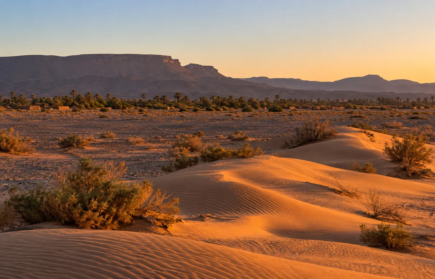
M'hamid El Ghizlane at a glance
| Status | Rural commune of Zagora province, Draa-Tafilalet region |
|---|---|
| Location | The last stretch of N9 tarmac, at roughly 500 m above sea level; the Algerian border is only a few dozen kilometres off |
| Population | 7,590 in 2014, then 6,664 in 2024; numbers have been dropping since the 1990s |
| Two halves | M'hamid Bali, the old village, faces M'hamid Jdid, the new one (the souk, shops, cafés, small hotels), across the Draa, a riverbed that stays dry nearly all the time |
| Spellings | Lamhamid Ghozlane, Mhamid Ghizlane, M'hamid El Ghizlane |
| What the name means | "Plain of the gazelles" is the usual reading, but it remains unproven. The older Berber name: Targala, or Taragalt |
| Same name, other place | A big district of Marrakech is also called M'hamid. It has no link with this village |
Searching online, keep that last line in mind: a result for "M'hamid" may concern the Marrakech district rather than the Saharan village. Look for Zagora province in the address before you book anything.
Getting to M'hamid: roads, distances, transport
| Starting point | Time | Distance |
|---|---|---|
| Marrakech | 7.5 to 8 h with no stops | Roughly 450 km |
| Ouarzazate | 4 to 5 h | 255 to 260 km |
| Zagora | 90 to 105 min | Roughly 95 km |
| Erg Chigaga, by track | 1 h 45 min | About 65 km |
| Foum Zguid, by track (via Chigaga and Lake Iriqui) | A whole day, 5 to 8 h | 130 to 190 km, varying with the line taken |
- By car: tarmac right up to the village, so a normal car is enough. From Marrakech the route crosses the Tichka pass to Ouarzazate, carries on to Agdz and Zagora, then heads south down the Draa.
- Fuel: Zagora has the last pump you can count on. Fill the tank there.
- By bus: M'hamid has had bus services in the past (CTM calls it Lamhamid Ghozlane), but lines and times change. Check before you leave, or ride a bus as far as Zagora and finish by taxi.
- By air: nearest airports, Ouarzazate (OZZ) and Zagora (OZG).
- To get your bearings: our desert map places Zagora, M'hamid, Erg Chigaga, Lake Iriqui and Foum Zguid in relation to one another.
What to see in the village and nearby
- The old ksar and Ksebt El Allouj (M'hamid Bali): earth houses clustered round a big kasbah. Ksebt El Allouj, for its part, is a Saadian-era fortified village (late 16th century); by tradition it watched over the caravans bound for Timbuktu and the gold dust they carried home. René Caillié came through in 1828 and left a description of the ksar of M'hamid.
- Palm grove and riverbed: free to enter, right down to the Draa, whose bed divides the two halves of the village and seldom carries water. Since the 1970s the palms have suffered from falling rainfall, encroaching sand and bayoud, a fungal disease of the date palm. A study puts the grove's loss at 36 % of its area between 1970 and 2018, most of it swallowed by sand.
- Ksar Ouled Driss: 6 to 7 km short of M'hamid on the road in from Zagora. A 17th-century ksar, with lanes covered by tamarisk beams, and doors of palm wood fastened with wooden locks. Its oldest house holds a small private museum.
- Oum Lâalag, the "sacred oasis": a spring ringed by about 15 hectares of greenery. Getting there: some 50 km of track to the south-west. The oasis lies 12 km from the high dunes.
- Lake Iriqui: inside Iriqui National Park, on the way between the two gateways. Dry in most years; exceptional rain filled it in autumn 2024, and it has emptied since (dry in 2025-2026).
- Activities sold in the village: camel treks lasting from one night to several days; 4x4, quad or buggy outings, always with a guide; stargazing nights.
Two festivals: the Nomads in spring, Taragalte in autumn
| Festival | Running since | When | What happens |
|---|---|---|---|
| International Nomads Festival (in French, Festival International des Nomades) | The early 2000s (2004, according to the organisers) | Spring. Older guidebooks say March, but the two most recent editions fell in April: the 20th on 10 to 13 April 2025, the 21st on 3 to 5 April 2026 | Programme in 2026: bread cooked in the sand, falconry, sand hockey, camel races, round-table debates and Sahel musicians (Toumastine from Niger, Tartit from Mali) |
| Taragalte | 2009 | Usually late October or early November; in 2024 it ran from 1 to 3 November. Dates for 2026 had not been released when this page was written | Roughly three days in the open air among the dunes near the village: music, poetry, a camel race, talks |
Dates move from one year to the next (the Nomads Festival has shifted from March to April), so check the organisers' announcements before you fix a trip around either event.
Which dunes from M'hamid: Erg Chigaga or Erg Lihoudi
| Point | Erg Lihoudi | Erg Chigaga |
|---|---|---|
| How far | 8 to 12 km to the north | About 65 km of track, 1 h 45 min by 4x4; no track reaches the erg faster (from Foum Zguid: 2.5 h) |
| Size | Small | About 40 km of dunes; some top 50 m (the 300 m quoted online cites no measurement at all) |
| Access | A normal car will do, with someone who knows the way | 4x4 needed, guide strongly recommended |
| Feel | Plenty of day visitors; Rough Guides reports litter and touts | Camps grouped on the east flank, the M'hamid side, in two clusters (north-east and south-east); towards Lake Iriqui, the west flank has very few |
- Chigaga camps: anything from a basic tent with shared washrooms to the so-called luxury camp, where each tent has its own bathroom, sometimes with a solar-heated shower.
- Who runs them: several M'hamid hotels have camps of their own in the erg.
- Season: most shut for the summer, roughly from June to August.
- Spelling: you will also see the erg written Chegaga; it is the same sand sea.
Sleeping in M'hamid El Ghizlane: hotels and guesthouses
Around the village: kasbah-style hotels with a pool, riads, guesthouses and simple auberges. The table runs in alphabetical order and sums up what each place says about itself online. It ranks nothing. On booking sites many of these addresses appear under "Bab Rimal", a common label but not an official one.
| Address | Where | What it advertises |
|---|---|---|
| Carrefour des Nomades | Towards Ouled Driss, about 5 km out | Berber-style hotel, around 17 rooms, pool |
| Chez le Pacha | In the palm grove | Grounds of 3 ha, some 36 rooms, restaurants, spa, desert camps |
| Dar Azawad | Ouled Driss, 5 km short of M'hamid | Earth-built boutique hotel, spa, hammam, heated pool, desert camps |
| Dar Sidi Bounou | Bounou, 5 km short of the village | A garden of huts and nomad tents around a small earthen guesthouse |
| Hotel Kasbah Azalay | In the palm grove, where the village begins | Kasbah-style hotel, about 43 rooms, indoor pool, spa |
| Kasbah Sahara Services | Right next to the village | Family kasbah with an orchard and a restaurant; tied to an outfit selling camps, camel rides and 4x4 trips |
| Le Drom'Blanc | On the edge of the village | 4-room guesthouse, pool, hammam, bivouac |
| Sbai Palace | Towards Ouled Driss | Riad-kasbah, about twenty rooms, pool |
- Simpler, in the centre: Auberge la Palmeraie or Hotel Sahara, for example.
- Water: it is scarce here, and according to Wikivoyage, hotel pools irritate some residents.
- Alcohol: a conservative village with no bar; some hotels serve it, others do not.
M'hamid climate, month by month
There is no official weather station in M'hamid. The values below come from a model (ERA5 reanalysis served by Open-Meteo, averages for 1991-2020), and that model slightly underestimates summer afternoons.
| Month | Low | High | Rain |
|---|---|---|---|
| January | 5 | 19 | 3 |
| February | 8 | 21 | 7 |
| March | 12 | 26 | 4 |
| April | 16 | 30 | 1 |
| May | 19 | 34 | 2 |
| June | 24 | 39 | 1 |
| July | 27 | 43 | less than 1 |
| August | 27 | 42 | 1 |
| September | 23 | 37 | 3 |
| October | 17 | 30 | 9 |
| November | 11 | 24 | 5 |
| December | 7 | 19 | 5 |
- Best period: October to April.
- Summer: crushing heat from June to August; the model's record is 47.5 °C, on 11 July 2024.
- Winter: below-zero nights do happen (-3.2 °C, recorded 8 January 1993).
- Wind: at its strongest in spring, through April and May.
- Rain: around 41 mm a year, yet a single autumn event can exceed that: the model counts roughly 114 mm for September 2024 alone.
- Further reading: conditions in the dunes are covered on our Erg Chigaga weather page; for choosing dates, see our guide to the best season for the Moroccan Sahara.
Good to know on the spot
- Fuel: the last dependable station is in Zagora. Fill up before driving down, and all the more so before the track.
- Cash: withdraw it in Zagora.
- Souk: every Monday, in M'hamid Jdid.
- Mobile signal: generally there in the village, weak or absent in the dunes.
- Sales pitches: a great many people sell desert trips here, licensed or not. Compare offers without rushing.
- Safety: the UK Foreign Office publishes no warning specific to M'hamid or Zagora. It does point out that Algeria's land border is shut and guarded, and that crossing it breaks the law. France's foreign ministry classes the border strip as yellow, heightened vigilance, a level below the advise-against zones; for the south it also mentions stray dogs and badly kept tracks.
- Guide: unnecessary in the village, strongly recommended for Erg Chigaga.
Choosing a gateway: M'hamid or Foum Zguid
- What M'hamid does well: it is the obvious next stop if you are travelling down the Draa from Zagora, on tarmac the whole way. The village also has more beds, more people selling trips, more camel treks, and two festivals.
- What Foum Zguid, our village, offers: it faces the other flank of the erg. On the track, allow 2.5 h via Lake Iriqui, which is longer than from M'hamid; but the full journey is shorter if you set out from Marrakech, Ouarzazate or Agadir.
- The full comparison: Foum Zguid vs M'hamid.
- Or both: go in on one side and come out on the other. Zagora to Foum Zguid: 2 h by road, 130 km; the options are on our desert tours from Zagora page. Foum Zguid is also where our two-day Erg Chigaga trip from Foum Zguid begins.
Questions and answers
Where exactly is M'hamid El Ghizlane?
In the Draa valley of south-east Morocco, at the point where the N9 national road stops. It is part of the Draa-Tafilalet region, in Zagora province, and sits at roughly 500 m, not far from the Algerian border. Postcode: 47402.
How many kilometres separate Zagora and M'hamid?
Roughly 95 km, all of it on tarmac: plan on 90 to 105 minutes at the wheel. Depending on the source, the published distance varies between 94 and 98 km.
Marrakech to M'hamid: how many hours on the road?
Count on 7.5 to 8 hours at the wheel with no breaks, for roughly 450 km, by way of the Tizi n'Tichka, Ouarzazate, Agdz and finally Zagora. Leaving from Ouarzazate instead: 4 to 5 hours, for 255 to 260 km.
Where does the name M'hamid El Ghizlane come from?
It is often rendered as "plain of the gazelles", but nothing confirms that reading for certain. In the past the place carried a Berber name, Targala (or Taragalt). You will also come across Mhamid Ghizlane and Lamhamid Ghozlane.
What are the dates of the M'hamid festivals?
There are two. Taragalte normally comes round in late October or early November; its 2026 dates were not yet known when we wrote this page. The International Nomads Festival is a spring event, and its 21st edition took place from 3 to 5 April 2026.
Which day is the M'hamid souk held?
Every Monday. It takes place in M'hamid Jdid, the newer quarter across the riverbed.
Can you find sand dunes in M'hamid itself?
No, not in the village. The small Erg Lihoudi lies 8 to 12 km to the north. For the region's big erg, Erg Chigaga, you cover about 65 km of track westwards (1 h 45 min by 4x4).
Is the M'hamid in Marrakech the same place?
No, the two only share a name. Marrakech has a large district called M'hamid, in the Menara area past the airport. M'hamid El Ghizlane is somewhere else entirely: a village on the edge of the Sahara, some 450 km away.